Tag Archives: California

California Mountains – Snow in Springtime

Spring was a happening thing in the high Sierra. Last winter extended well into June, and on at least one date that month the snowpack was the highest on record. This means that at the end of July when we were there, quite a bit of snow was still melting.

Leopard Lily

From our trailhead at nearly 10,000 feet, we only ascended another 1,000 feet or so, but the difference in the flora was notable. Higher up, the flowers and shrubs were still in bud; the snow hadn’t been gone long.

Willow buds
Mountain Pennyroyal in bud


The violent weight of snow had deformed this cluster of trees in such a symmetric way as to be artistic.


Spearhead Lake


Rosy Sedum with Buttercups

At the highest elevations, every lovely bloom seems like a miracle, when you consider how much of the year the plants are just roots or seeds under the snow, how quickly they are required to respond to the light and warmth and come into their glory.

In some places they were sprouting out of a puddle where snow had likely been lying a few days previous, like in this low place I had to hop over to reach a spot overlooking Long Lake. You can see Mr. G. in the distance ready to spread out our picnic of cheese and crackers.

Around us and at our feet hot pink penstemon was making for a brilliant contrast with the midnight blue water and the granite rocks.


California Mountains – Directions and Points

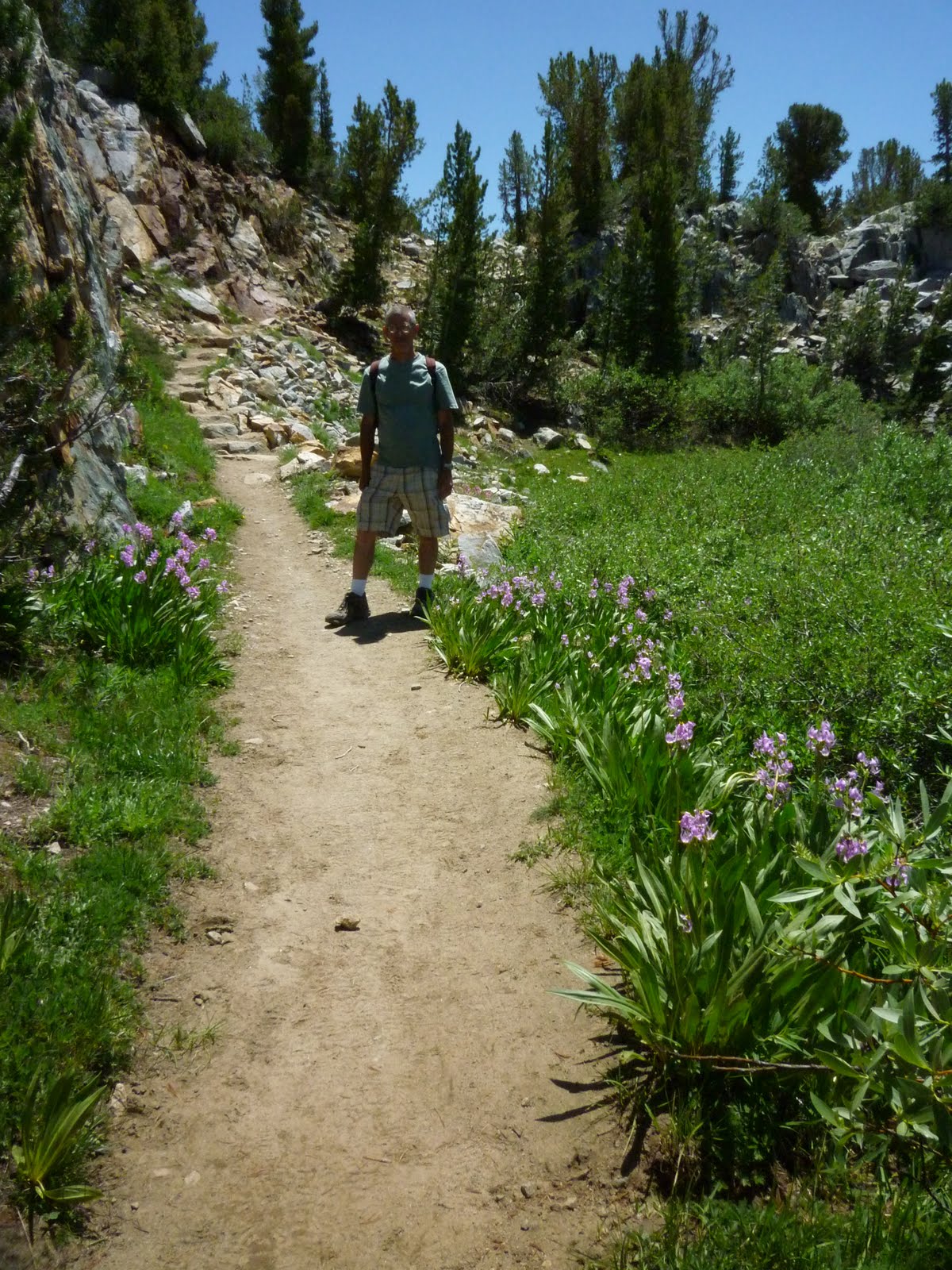
Mr G. with shooting stars

The point of going to the eastern slopes of the Sierra Nevada was to take a hike out of South Lake, above the town of Bishop. When my husband first proposed this trip, I liked the idea of driving to a trailhead that is already high up there; I knew that our day hike would likely not be too strenuous.

After spending the day driving down from Tahoe, mostly on Hwy. 395, we stayed at a nice motel that made luxuriating possible. Making the most of our relaxed schedule, we didn’t get to the trailhead until what was to us an embarrassingly late hour, and I’m not going to publicize it here. When we left Bishop, though, it was already 80°.
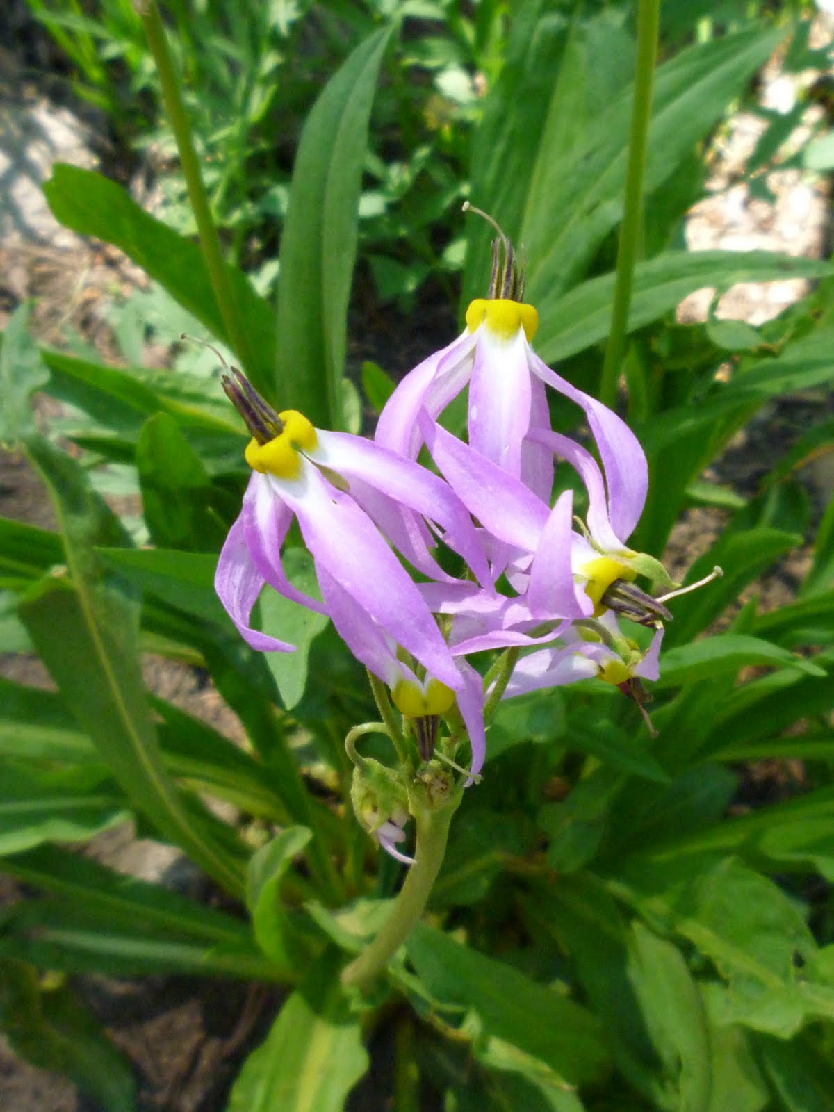
shooting star

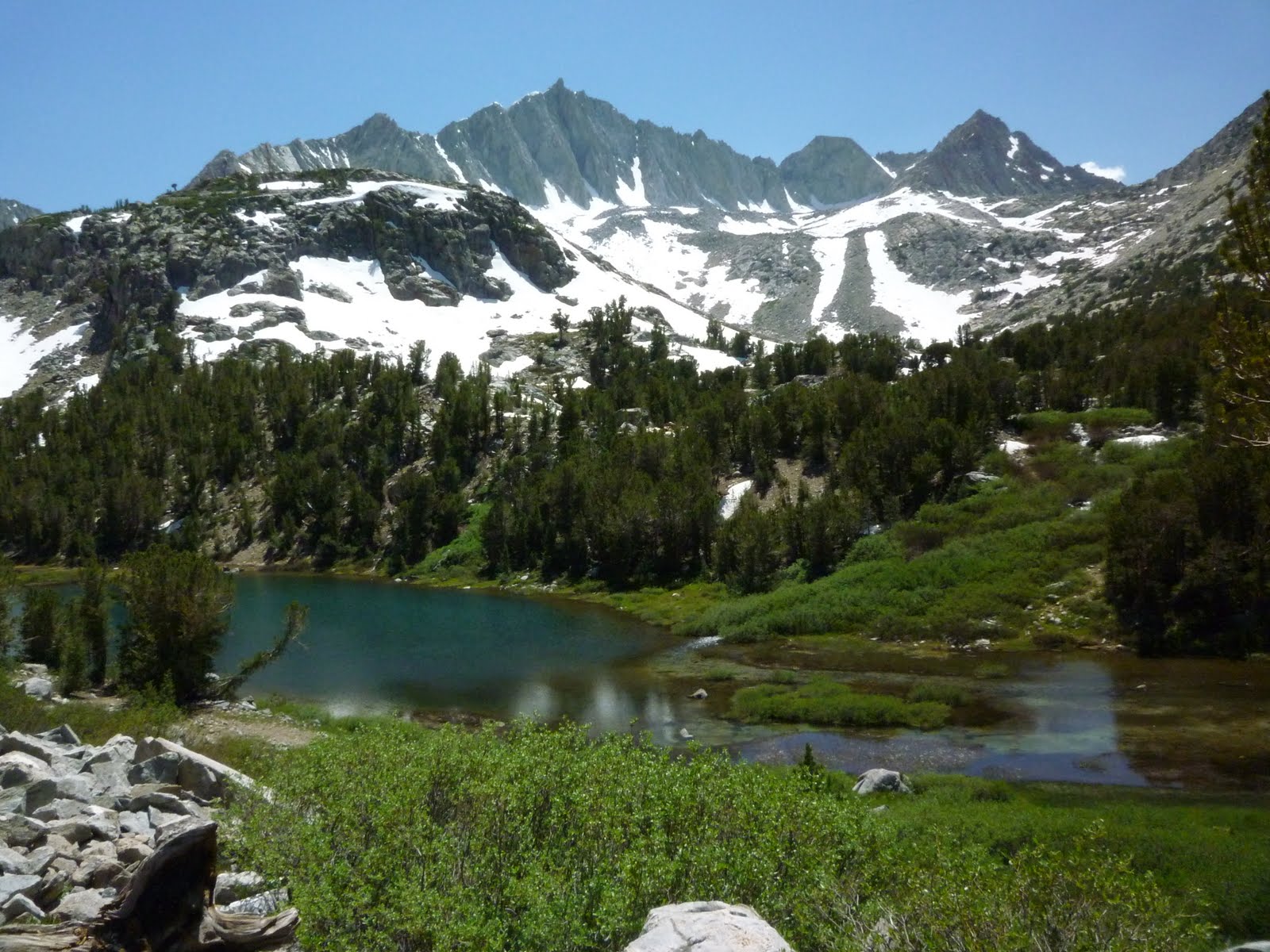
A mere 22 miles up the road, the temperature had dropped to 60° — because we had gone in the upward direction 5,760 feet. We got nice and warm, hiking for six hours close to the sun, but the thermometer never rose above 75°. When we stopped to cool off or take a drink, we could quickly do that in the shade of a boulder — but the mosquitoes liked the shade, too.

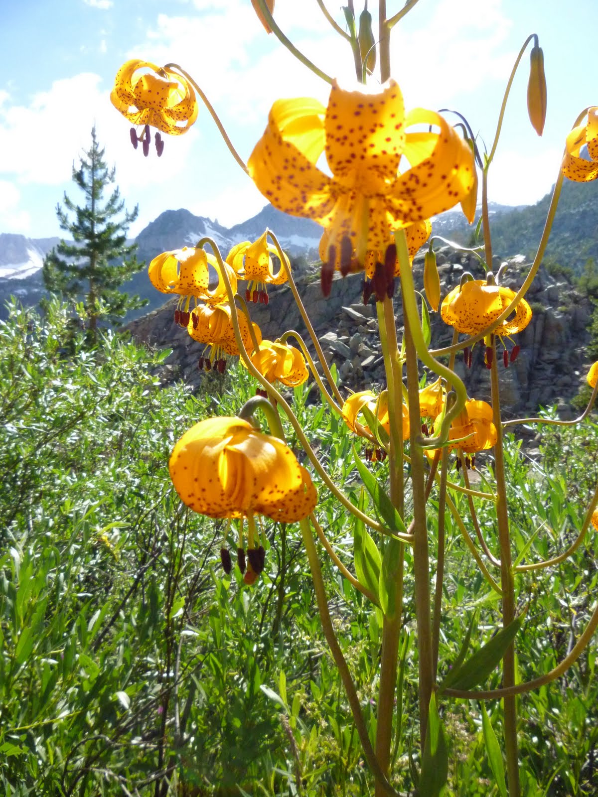
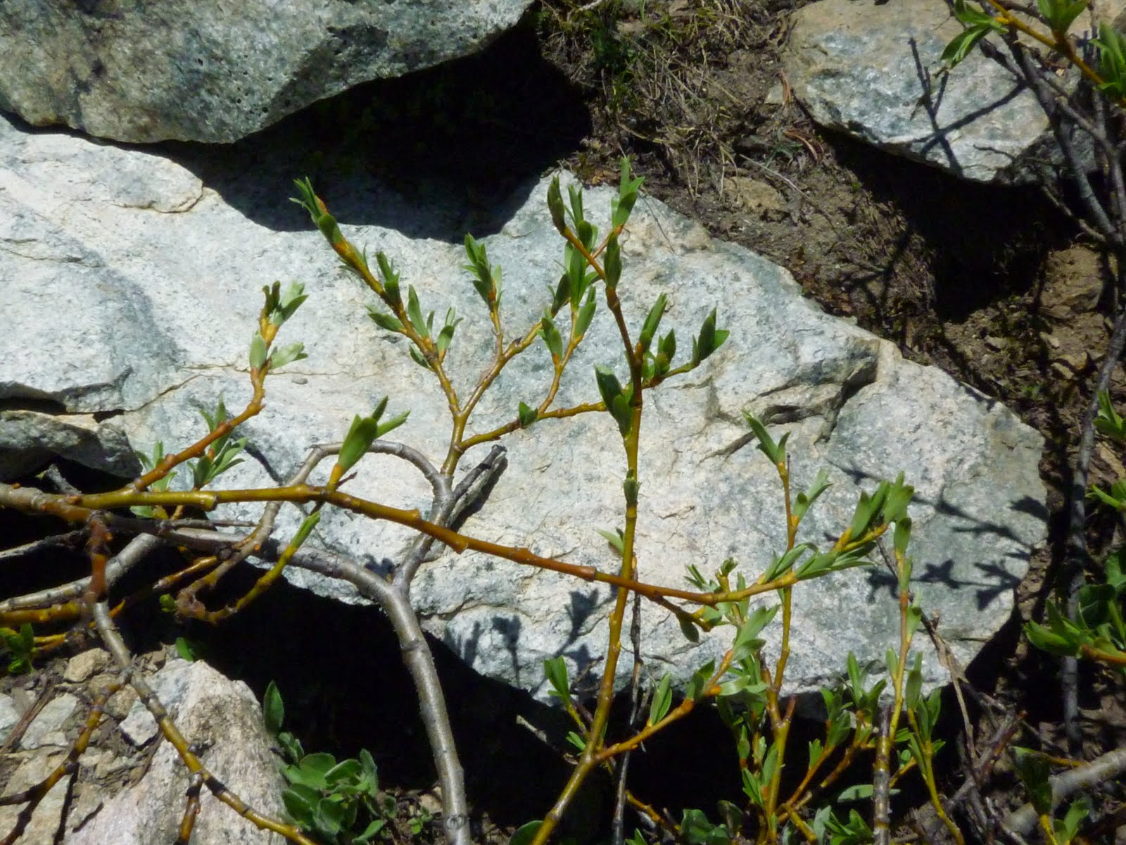
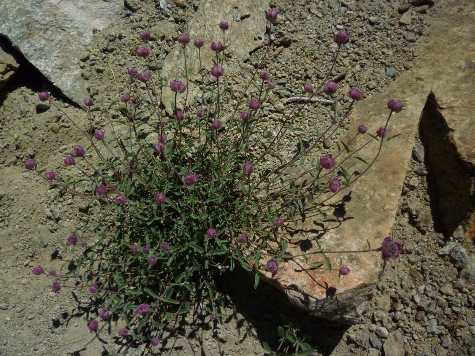
I couldn’t begin to photograph all the flowers and many of my pictures came out too bright owing to that midday sun. Anyway, Mr. Glad and I had made a deal that I would leave some space on the memory card for his shots of larger landscapes and peaks, so for ten whole minutes at a time I would try hard to pretend that I didn’t have a camera with me.

I did think many of my readers would appreciate the one mountain picture I took myself, of this brown peak (at right). Now ladies, does it remind you of anything? How about…a heap of cocoa powder, maybe? It’s called Chocolate Peak.

It was odd that I didn’t feel a need for the boost a dark chocolate bar might give me, hiking along a trail that continued to ascend in the direction of Bishop Pass for our first few hours, up where the air is thin.

I did need to stop pretty frequently to catch my breath, but all in all I was exhilarated, and my mind was composing about 20 different blog posts in an effort to process all the beauty and excitement of the dramatic topography.

When we got back to the car I quickly wrote a few notes to work from when back home in front of the computer. Sadly, when that time came a few days later, I found that without the context that stimulated such a fervent response in me, I couldn’t even recall all the main points that were to flow from the title of this installment.

Since he was a young boy my husband has liked to hike up to mountain tops or mountain passes where he could get a view, and know that he had reached a specific goal. I, of course, would be happy to sit by a field of flowers and work on taking close-ups while getting whiffs of pine needles on the breeze.

That’s partly because I long ago found that orienteering is not my thing, as was well demonstrated on this hike. During the outward bound portion I felt, without thinking much about it, that we were hiking in an easterly direction, but looking at the map later, I learned that our path led pretty much due south.

And every few minutes the mountains change position relative to one another, as it seems when you are getting closer to one and seeing the other side of its neighbor, so I never learn to recognize them. This is one reason to hike particular trails until they become familiar.

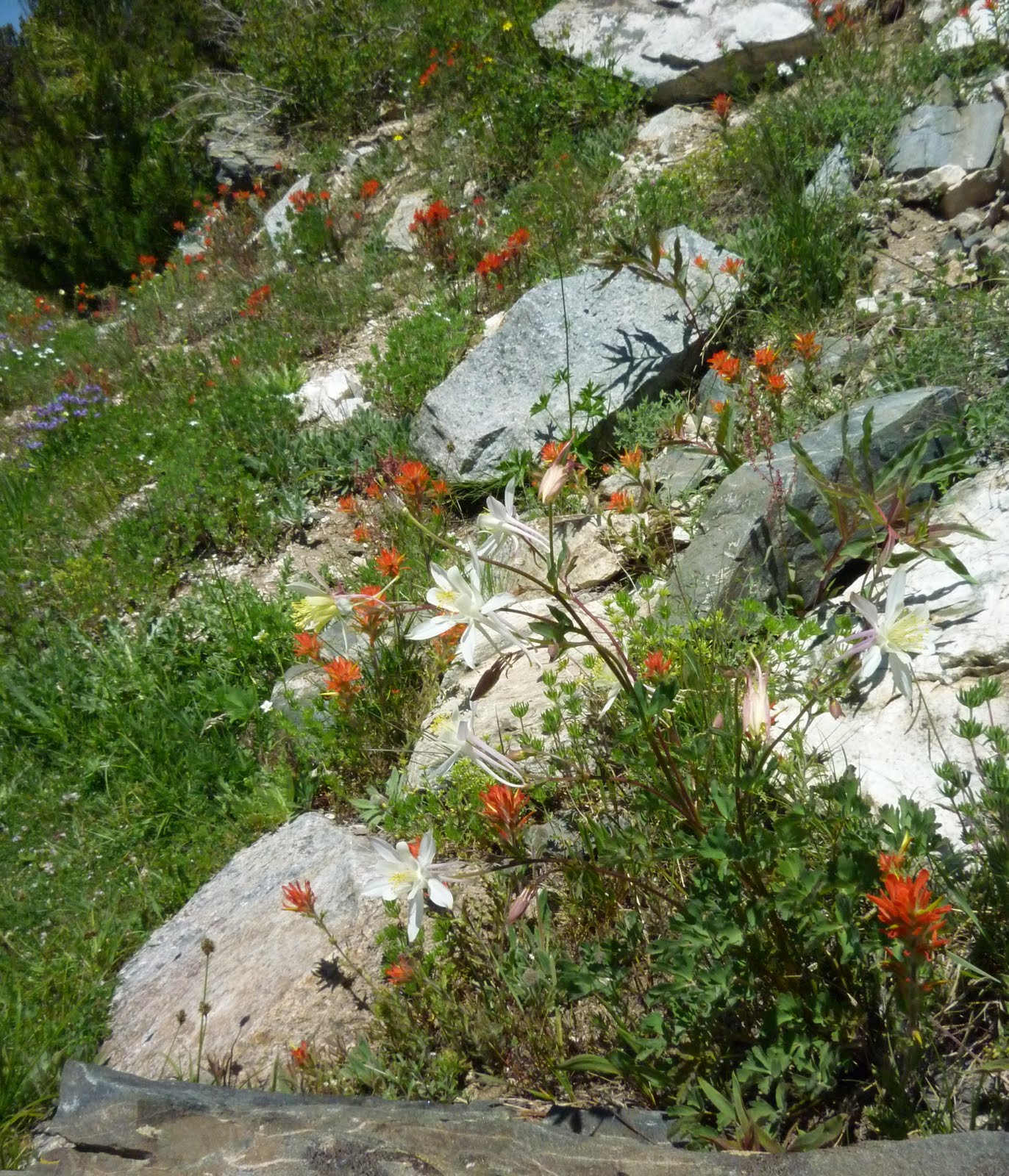
paintbrush and columbine with granite

That is probably not going to happen, considering how our hikes are less frequent these days. As for reaching a panoramic viewpoint or summit of anything, on this hike we didn’t try to accomplish that goal. At an unremarkable spot along the trail, Mr. G. merely said, “I think we should turn around now and go back.”

Of course, he knew that the next day he’d get fantastic views of many of the particular mountains he’s come to love during his life. And that is a hint as to the upcoming posts on California Mountains.

(Previous posts in the series: Getting Over,
Tahoe, Rivers and a Song )

California Mountains – Rivers and a Song

(This is the 3rd installment of my July vacation travelogue.)

Lake Tahoe sits on the California-Nevada state line, and the rivers in the surrounding mountains form the setting of the ballad “Darcy Farrow.” Ian and Sylvia were singing this song the first time I heard it, and I still think their rendition is the best. I heard many examples on YouTube while looking for one to post here.

As we drove down the highway south from the lake, we weren’t far from “where the Walker runs down to the Carson Valley plain,” and in fact we crossed all three rivers mentioned in the tale, the Truckee, the Carson, and the Walker. We even listened to Ian and Sylvia sing from the CD player at one point in our journey.

Of course I don’t like that Young Vandy put a bullet through his brain, but in comparing this story with other traditional songs I find I like it better than ones where the young man instead kills his beloved by accident or out of anger.

These rivers descend toward the east from from the northern Sierras and always refresh my mind as I watch them from the car. The Walker stays close to the highway longer than the others, and where it flows through desert-like terrain it captivates me by the contrast it gives to the sagebrush-covered banks. It’s fast and furious and carrying a lot of irrigation for the green fields of alfalfa grown farther east where the land flattens out. I recall those expanses of green and the beautiful Nevada cattle ranches in the shadow of the mountains — but we didn’t go that way this trip.

Four years ago we visited this area, and I wrote hasty notes in my journal as we sped along through ever changing layers of conifers, sagebrush, aspens and meadows, trying to preserve the moments of beauty. I didn’t get to catch my own photo of the rivers on either trip, but I found this one on the Web.

And below is one of ours, showing the mountains where the heavy snowpack from last winter is still melting and filling the rivers with icy water. On Hwy. 395 this far north the elevation is still above 5,000 feet so the summer temperatures don’t get extreme. The cattle looked content, and I know I was.

California Mountains – Tahoe

( 2nd of many posts in a series. 1st post: Getting Over )

Our neighbor camper played his lonely and cheery mandolin for hours each day that we were at the Meeks Bay Campground.

We had pitched our tent within walking distance of the beach, where we were surprised to see three or four Canada geese looking for handouts or taking a dip with the other bathers. The many children liked to chase them in the water occasionally, but the geese always swam faster than the children could run through the chilly waters.

The lake is high this year, the beaches shrunken, but we found a spot to plunk our chairs down in the sand with a view to people-and-geese-watch, glancing up often from our summertime reading.

GJ above Emerald Bay

Mr. Glad casually and calmly swam in the lake for ten minutes at a time, completely disguising the fact that it was cold — he estimated 60°.

I was content to wade fairly quickly out to a rock where I could sit and admire my manly husband, whom I compared to a younger, fatter guy who no sooner entered the lake than he headed right back to the dry sand moaning and sputtering and making a scene.

Bridges’ Gilia

The quaking aspen trees shaded our tent and made a lovely shadow picture on the roof in the mornings, and Indian Paintbrush flowers waved at the front door. Steller’s jays helped to wake us up early with their raspy voices.

Lake Tahoe lies at about 6,000 feet elevation, which makes for chilly nights and mornings, but a noontime picnic can be plenty hot if your site’s table is in the full sun.

We took a short hike to Eagle Lake, above Emerald Bay, and captured some wildflower images. The purpley one Pippin and I think is Bridges’ Gilia or Gilia leptalea, though it also seems to have a new and updated botanical name for some reason: Navarretia leptalea.

Photo by Mr. Glad

I especially liked to visit the beach at night when it was empty and the water was shimmering. Little waves were going blip-blip-swish on the sand, where by their tracks you could see that the geese had been the last creatures to go to their rest.